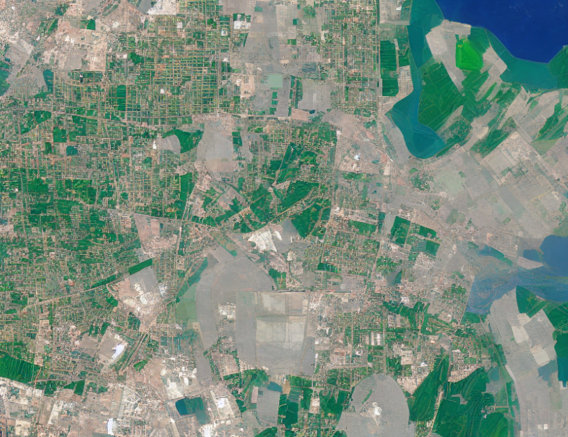
In this article, we explore the problem of optimizing the resolution and incidence angle of satellite images to cover a certain area. The goal is to minimize the resolution while ensuring that the images are in a cover, which means they are in the same location as other images with similar resolution. The first step is to linearize the objective function by minimizing an auxiliary variable that represents the maximum incidence angle of the images in the cover. This helps us to find the best approach for solving this problem.
The article presents several strategies for solving this optimization problem, including OR-tools default, OR-tools greedy, Gurobi, Gecode default, and Gecode greedy. These strategies are compared using a set of experiments that demonstrate their performance. The results show that OR-tools default is the best approach for 13 out of 24 instances, with an average score of 0.847. OR-tools greedy is the second-best strategy, followed by Gecode greedy and Gurobi.
The article also considers the importance of providing a Pareto front from which users can choose a cover, as this can save time and money. Finally, the article discusses other objectives that could be considered in future work, such as minimizing the average incidence angle instead of the maximal angle.
Metaphor: Optimizing satellite image resolution is like trying to make a puzzle fit perfectly together. We want to find the right balance between different pieces so that they all fit together smoothly and efficiently, without any gaps or overlaps. Just like how we need to choose the right pieces for the puzzle, we need to select the right images with the right resolution and incidence angle to cover the area effectively.
Conclusion: In summary, this article discusses the optimization of satellite image resolution and incidence angle to cover a certain area. The problem is complex but can be broken down into smaller parts using linearization techniques. Several strategies are proposed for solving the optimization problem, and their performance is evaluated through experiments. The results show that OR-tools default is the best approach, followed by OR-tools greedy and Gecode greedy. Providing a Pareto front can help users choose an effective cover quickly and efficiently. Future work could consider other objectives such as minimizing the average incidence angle.
Artificial Intelligence, Computer Science
Optimizing Satellite Image Mosaics: A New Approach to Reduce Cloud Coverage